Woodhill Diary
(return to index page)
Thursday 4 January 2007
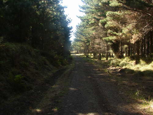
Back to Rimmers bright and early, with the big pack, about 12kg including the camera bag hanging off the front. Goal: to walk as far south down Coast Rd as I could in 2 hours, have a rest, and then walk back. Straight, fairly level gravel road bordered by pine forest. Miranda has a full clinic this morning so it's just Alice and me.
As this year's big walk, as far as I can read between the lines, is mostly fairly level or slightly downhill river valleys I want to push that training distance out a bit. The biggest day on the Greenstone is some 20km from McKellar Hut to the new Greenstone Hut. I want to be doing at least that along Coast Rd, and carrying about 20kg.
We get under weigh just before 9 am. The other day I mentioned the notice about the surveillance camera, and I've got a shot of that today, and also one of the Carter Holt sign right alongside of it.

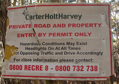
For as long as it took to trim the overhanging pine branches along Coast Rd some time in the last month or so, this sign might have been applicable. For the previous umpteen months and years, it could be and I imagine has been safely ignored. It's all too much like the proverbial dead watch, showing the correct time twice a day. The trimmings from the pine trees still litter the ground in the carpark.
It might be interesting one day to ring up and try to obtain a permit.
Years ago, in London on my OE, with a whole day to spare, and very much a fan of UB40's music, I attempted to enrol for the dole so that I could catalogue the runaround and see just what the British Civil Service was capable of. I spent five hours being directed to one queue after another, waiting patiently until I reached the front each time only to be told I was in the wrong queue and should be in that queue over there. Anticipating this I had brought a book, plenty of sandwiches and a thermos. As an exercise in apathy and frustration it was inspirational.
(The initial form you fill in to apply for the dole is form UB40)
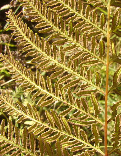
Today I'm paying a little more attention to the native plants that are growing alongside the road. I find three ferns, and a couple of prominent natives. The ferns are firstly, Pteris tremula, the Shaking Brake or Turawera. The name derives from the responsiveness of the fronds to wind movement.
The Brake family of ferns is named for a "brake": a place overgrown with bushes, brambles, or cane. In other words the Brakes are hardy inhabitants of wasteland. Hmmm. An obvious member of the family is "bracken" with the same derivation.
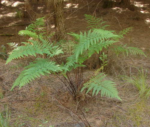
This fern survives well in quite dry conditions. It is often encountered as a weed or chance arrival in older gardens, springing forth decoratively in some dry and more or less neglected corner. The bigger fronds have more divided pinna towards the base. Probably they're identifiable from their growth habit as much as anything else.
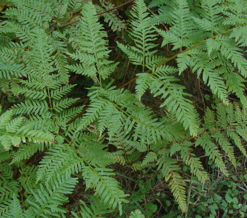
The bigger and older fronds have quite characteristic spore patterns on their lower side.
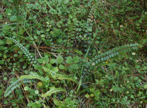
This close to the coast it's by far the most common fern. The eastern forest areas at Woodhill have a somewhat greater variety. Along the 5.6 km stretch of road, I see, besides these, a couple only of Pellaea rotundifolia, the Button Fern, or Tarawera.
There is also one small patch of Shining Spleenwort, Asplenia oblongifolium, or Huruhuruwhenua. Here is a young one not long ago pushing itself through the carpet of needles.
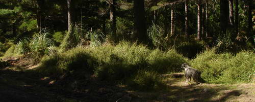
When I first start the trees offer plenty of shade but the intensity of the sky is fair warning for what it will be like later.
The commonest native plant along here outside the ferns is Muehlenbeckia complexa, or Pohuehue. What you can see along here is its use of pine trunks as a support for its scrambling habit.
It's quite thick along the roadsides. Alice has a go at negotiating it and gives it away.
I notice also, not long after the start that one of the large concrete water tanks along the road has been removed. There's been some action here, with many of the coastal access tracks for horses freshly bulldozed, as well as the trees along the roadside being freshly trimmed.

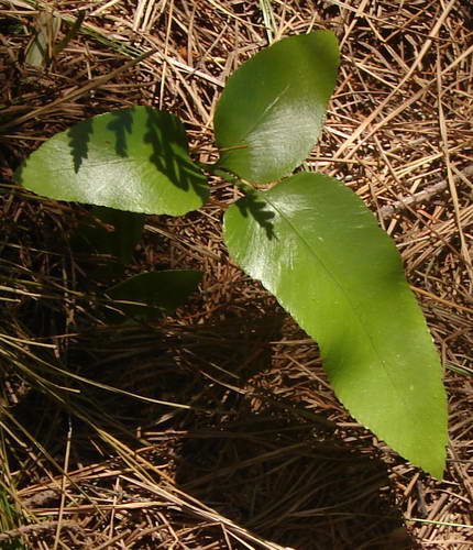
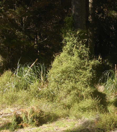
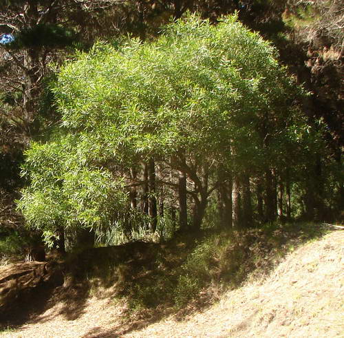
The other native plant along here is one that is not readily obvious as a native. In fact it looks more like an Australian. This is understandable as it's a fairly close relation of the bottlebrush. It's the toru, or Persoonia toru.
Here is a tree, lemony green gold against the darker pines
We pass Mission Rd and then Willets Rd and continue south until we reach the southern end of the Long Loop Track just as two hours is showing on the clock. I take the pack off, find a shady spot and stop for a cuppa and a piece of fruitcake. Alice approves and gets a long drink of water to wash her bit down with.
I doze in the warm shade, and wake with a start about half an hour later. Time to head back. I decide to make the return trip a heads down and push effort and my heart rate is soon up there where I want it. I am pleased with how little the big pack is affecting my walking strength or stamina
Alice is less impressed, and when we are passed by a mountain bike, sets off to show what she can do, and it is only after about 300 metres as the cyclist rises to the challenge that she gives it away and hoons on back. That is something we are going to have to deal with before some child gets knocked off its bike on the main road. Later I grab her as some horses cross in front of us. When I let her loose after they have disappeared across the road and into the forest, she heads off after them.
I am rather short with her when she comes back and she walks behind me for a bit before deciding I am going too fast, I am grumpy company, and when I look round she has disappeared. Not a sign or a response. I take a chance and head swiftly back to the van, about a kilometre, crack a beer from the fridge, and start the motor. Before I have time to finish the beer I can see her rocketing down the road in the rear vision mirror. I don't know whether to be pleased or apply the boot. In the end, pleased wins, but it is a close thing.
As I am driving out I glance at the big "fire risk" sign near the forest entrance. The fire risk arrow is pointing to 2 out of a possible 5. Medium Risk, with High, Very High and Extreme still to go. This is consistent with the green pastures and hillsides around Helensville, probably greener than I've seen them in January for years with plenty of feed in the paddocks. Last Tuesday I headed out towards Waionui Inlet at South Head with my niece Anna and discovered a large Carter Holt Harvey sign just north of Parakai saying that all access to the northern forest had been closed due to excessively high fire risk.
It should have been a Tui beer ad.
But unfortunately it wasn't.
PS Waitakere fire risk is also showing as medium. Maybe there is a communication problem at CHH.
|